Logo
Promoting the Rio de Flag's natural stream system as a unique and valuable natural resource

My Account

  • Become a Member

Menu

  • Home
  • About Us
    • Our Board
    • Join the Board
    • Contact Us
    • Donate
    • Annual Reports & Board Meeting Minutes
  • News and Events
  • Projects
    • Adopt the Rio
      • Teaching Resources
    • Wildcat Reach
    • Cheshire Wetlands Restoration
    • Flood Control
    • Frances Short Pond Wildlife Project
    • Leroux Springs Monitoring
    • Rio in Southside
    • Watershed Plan
  • Discover
    • Map of the Rio
    • Cheshire Wetland
    • Foxglenn Park
    • Frances Short Pond
    • F.U.T.S. Downtown
    • Leroux Springs
    • Logan’s Crossing
    • Picture Canyon
    • Springs of the Rio
    • Willow Bend
  • Resources
  • Gallery
Menu Spacer

Map of the Rio

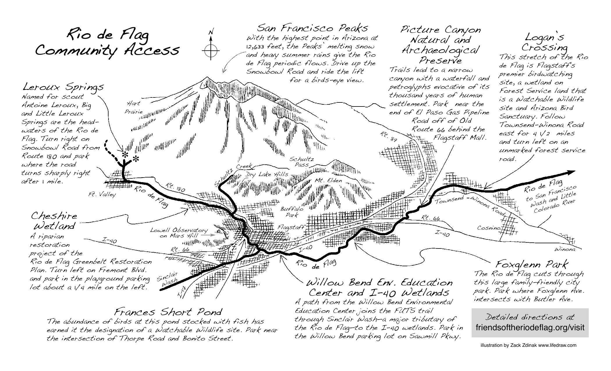
Follow the Rio through the Rio de Flag Watershed on the map below (click the map to view in a separate tab). Afterwards, explore sites along the Rio in more detail by clicking on the list of site links.

Zacks_RioDeFlagMapDiscover the Rio:

  • Leroux Springs
  • Cheshire Wetland
  • Frances Short Pond
  • Willow Bend
  • Fox Glenn
  • Picture Canyon
  • Logan’s Crossing

Website design & development by FlagstaffConnection.com © 2015 All Rights Reserved.

  • Become a Member
  • Donate
Follow us on Facebook